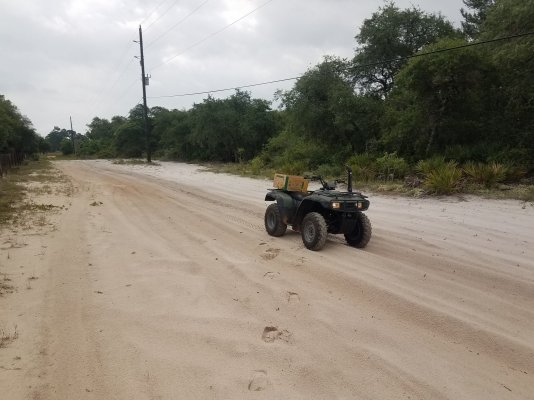
I've pulled so many people out of this same spot it's just ridiculous!
So I will try to explain how stupid it is with this map. The blue lines are roads that are either paved or well-maintained hard-packed clay, the red is pure bottomless white sugar sand. The yellow ends are dead ends showing that there is just one way in and one way out of the neighborhood which essentially is a loop with one little branch going to the west. So for some reason, the GPS for delivery drivers, not just amazon but USPS, UPS, FEDEX, Uber all sorts of people tells them to go down the red road even though there is not a single residence addressed on that road and its out of the way in most cases, people are so stupid they don't look at the obvious deep ruts and just dive right in! The West side of the road is about 1,320 feet long and the right side is 660 or so. Usually, the cars or vans make it to the dead middle, where no wrecker can reach with their winch and their only hope is to dig and flog their POS foot by foot, pay for an off-road recovery which is not cheap, or have a good neighbor stop by and pull them with a 4x4 and rope. The 4x4 and rope method is not always easy because even a diesel truck will struggle to pull a car out of pure sand just due to weight and lack of substance beneath them.
Here is a picture to show how sandy it is.


